
Water Flow in the Cedarburg Bog
Jim Reinartz, FOCB President
In previous issues of the BogHaunter (Spring 2025 and Summer 2025) I discussed the Bog’s water budget and the contributions of groundwater to the Bog. Inflow of groundwater (Figure 1) constitutes only about 2% of the Bog’s water budget. However, it has a disproportionately large influence on the ecology of the Bog because of its effect on the chemistry of the wetland.
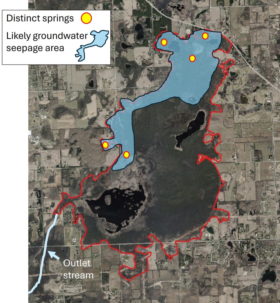
Figure 1. Likely groundwater seepage areas in the Bog and the only surface water outlet stream.
The details of the course that water takes as it flows through the Cedarburg Bog are largely unknown, but there is evidence that we can use to understand the general patterns. There is only one surface water outflow from the southwest corner of the Bog at Mud Lake. The peat surface is about 8 feet higher at the north end of the Bog than at Mud Lake and the outlet stream (Figure 2). So, we know that surface flow in the Bog is in one general direction from the north end to the south.

Figure 2. Contour map of the Bog area.
While the mechanism of string formation is not completely understood, it is well-known that the elevation gradient and surface flow in string bogs is always perpendicular to the orientation of the strings. So, we can use the orientation of the strings to interpret the direction of water flow in that part of the Cedarburg Bog (Figures 3 and 4).
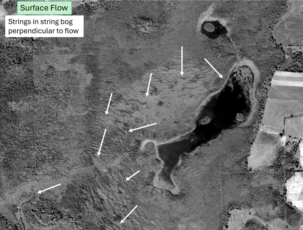
Figure 3. Orientation of strings and the direction of surface flow.
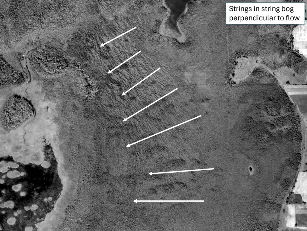
Figure 4. Orientation of strings and the direction of surface flow.
Putting all this information together, we can form a general picture of surficial water flow in the Bog (Figure 5). Permeability to water flow is orders of magnitude ( a million times!) higher in the peat at the surface of wetlands than at deeper levels where the peat and muck are more decomposed and compressed. Nonetheless, surficial flow through the upper levels of the peat and in any small channels where the surface water is connected is undoubtedly very slow. The water is held back and slowed by the sponge-like structure of the peat.
It would be fascinating to know how long it takes a drop of water entering the north end of the Bog to make its way to the outlet stream. That retention time could be measured in months or even years.
From what we know about where our mineral-laden groundwater enters the Bog and the patterns of surface flow (Figure 5), we can see that it is unlikely that groundwater ever reaches the southeastern lobe of the wetland. In a future issue of the newsletter, I will discuss how the surface flow patterns have influenced the development of plant communities in the Bog.
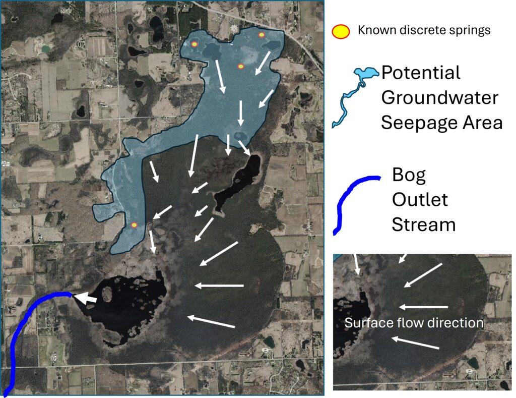
Figure 5. General patterns of surface flow in the Cedarburg Bog.
