
Groundwater springs are found in the northern and western parts of the Bog. Why are they found in those locations and why is groundwater important?
In the last issue of the BogHaunter I described the Bog’s water budget (inflows and outflows). Precipitation directly into the Bog and evaporation and plant transpiration (loss to the atmosphere) are the two major components of the water budget. Groundwater inflow to the Bog is a relatively minor addition of water to the budget compared to precipitation.
However, because our groundwater is so hard (with high levels of calcium and magnesium ions), a small addition of groundwater to the system has a large effect on the chemical budget of the Bog. Inflow of hard groundwater is responsible for the neutral pH of the Cedarburg Bog (pH = 7) which prevents the wetland from developing an acidic pH like a true bog. The influx of groundwater makes the Cedarburg Bog technically a minerotrophic fen, not a bog.
Unlike ombrotrophic bogs, which rely solely on precipitation, fens receive ground water with nutrients and minerals dissolved from rock and soil. Fens are typically more fertile than bogs and therefore support a greater diversity of plant species compared to bogs.
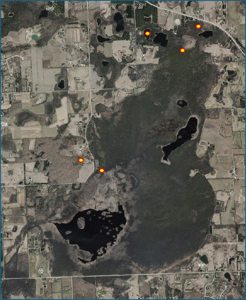
Figure 1. Locations of known distinct groundwater springs into the Cedarburg Bog.
We are certain there is an influx of groundwater to the Bog because some of it flows from distinct springs (Figure 1). The Bog’s water budget, discussed in the last newsletter, also requires some inflow of groundwater to balance the budget between precipitation and evapotranspiration. In general, groundwater enters the Bog from the north and west. In addition to the distinct springs, the abundance of skunk cabbage, a groundwater indicator plant, suggests that some groundwater may seep into the Bog throughout its northern and western areas (Figure 2). It is likely that Donut Lake is also an area of groundwater discharge to the Bog.
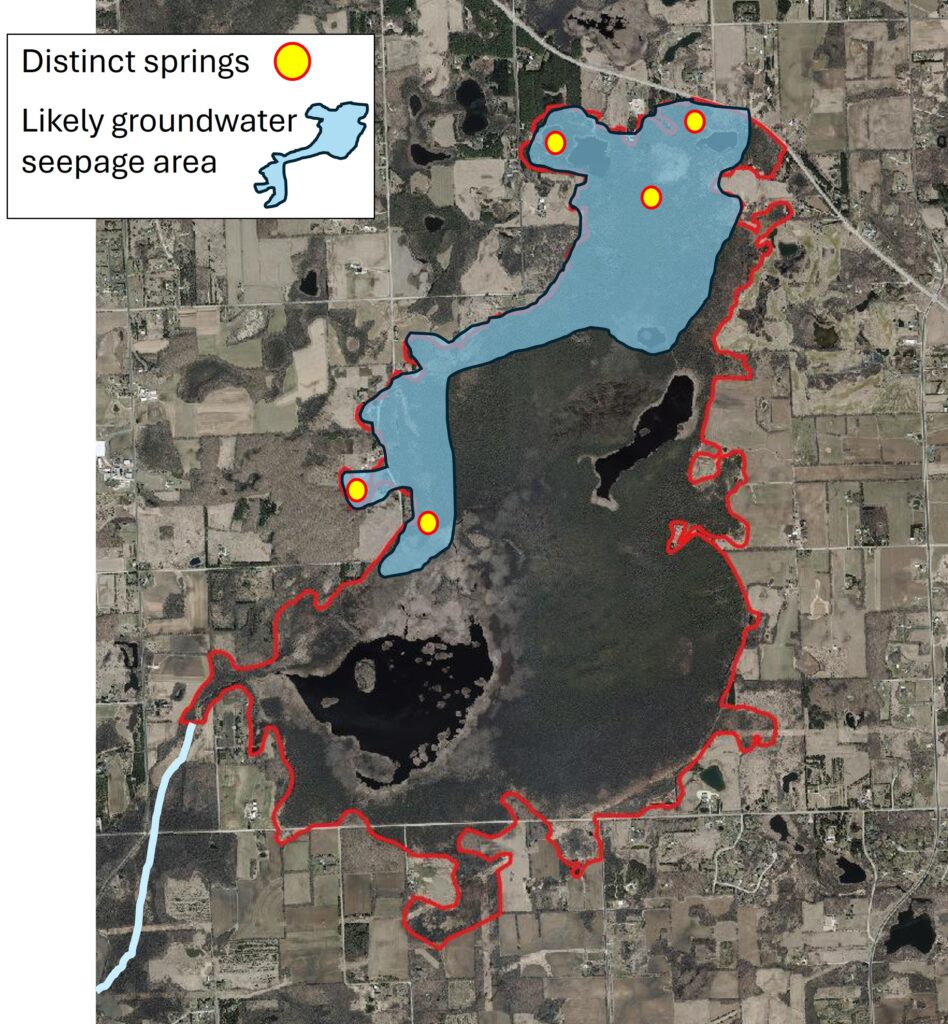
Figure 2. Areas of the Cedarburg Bog likely to have the greatest inputs of groundwater.
Why do only the north and west areas of the Bog receive groundwater? The Bog sits on a subtle topographic high spot compared to the land between the two streams that drain the area (Figure 3). At 865’ Above Mean Sea Level, the Bog is 10’ higher than the North Branch of Cedar Creek to the west, 82’ above Mole Creek less than a mile to the east, and 120’ higher than the Milwaukee River to the east, which ultimately drains the entire watershed.
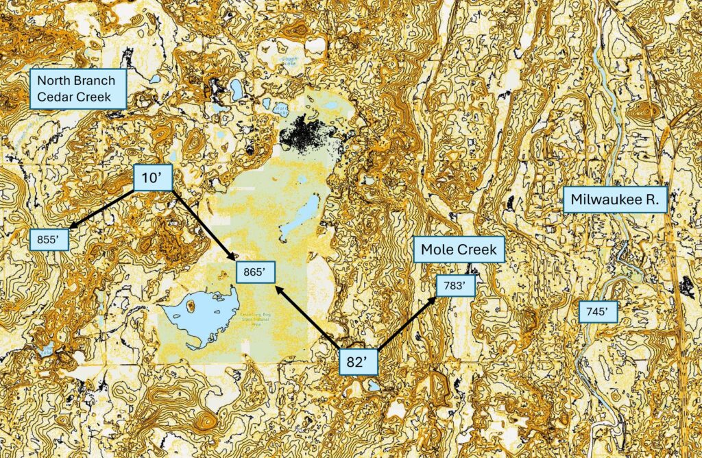
Figure 3. Topographic map of the Cedarburg Bog area with elevations of key hydrologic features labeled. Source: Ozaukee County GIS website.
Groundwater flow follows the general contours of the land surface in the area and is from west-northwest to east-southeast through the region of the Bog (Figure 4). Very tight impervious clay lines the bottom of the Bog’s basin. Water cannot pass through this clay lining where it is intact, so much of the groundwater flow into the Bog probably occurs in discrete springs where that clay lining is discontinuous. A model of the groundwater elevations through the area of the Bog (Figure 5) illustrates why springs and groundwater seepage are found in the northern and western parts of the wetland.
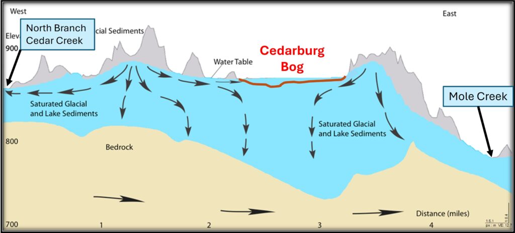
Figure 4. A west-to-east cross section showing general directions of groundwater flows in the bedrock and unconsolidated glacial deposits under the Cedarburg Bog area. The regional flow of groundwater is to the Milwaukee River to the east. The vertical scale of the cross section is greatly exaggerated. [Source: David Hart and Joanne Kline, 2013. Identification of Contributing Areas for Groundwater Supply to Cedarburg Bog to Protect Critical Habitat, WGNHS Technical Report, 82 p.]

Figure 5. Conceptual model of the relationship of the Cedarburg Bog to the local groundwater table and the tight impervious clay that lines the Bog’s basin. The slope of the groundwater table is exaggerated to emphasize the relationship.
On the eastern side of the Bog the wetland is “perched” above the groundwater table under the Bog. The spring-fed lake on the golf course just east of the Bog is 21’ lower than the surface water elevation of the Bog. The Bog’s clay lining holds the water in the relatively shallow basin of the Bog and maintains the water levels in our wetland.
In the Fall issue of the newsletter, I will discuss how water moves on a complex path within and through the Cedarburg Bog.
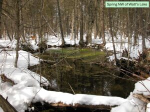
Spring NW of Watt’s Lake
